

Oh, Canada! What Wonders Await.
- Ian
- Feb 27, 2025
- 33 min read

Updated: Mar 3, 2025

Given the current state of affairs in the United States and the hostility being displayed by 'he whose name must not be spoken' (to borrow from Harry Potter) it is not surprising that droves of Canadians are canceling travel plans that were stateside. It is a shame because the majority of Americans love Canada and I know this first hand because I am a Canadian living in the US and I can honestly say I don't know a soul here who espouses 'his' opinion of Canada. That being said, the reaction to forego trips to the US (and to buy Canadian where possible) is completely understandable and justifiable.
So, for those who did cancel plans for travel, don't despair! Canada is a vast country with a diversity to its landscapes that is almost unparalleled. Equally diverse are the inhabitants who call it home. With a population of just over 40 million and a square area of 9,984,670 square km of which nearly 900,000 are fresh water lakes (I did not know that Brazil actually has the most fresh water of any country, did you?), it has one of the lowest population densities in the world at roughly 4 people per square km. With all of this open space it isn't surprising to learn there are thousands of unique and amazing locations where one can see incredible geographical wonders or cultural experiences essential to Canada's history.
To try and record all of them, even just those we know about, would be a Herculean task but, having driven coast to coast in the country, I wanted to compile a list of some of the amazing spots one can encounter throughout the provinces and territories. Some are hidden gems, others perhaps better known, but all are worth a visit to explore the rich landscapes and/or historical significance each offers.
Jump to:
1. British Columbia

Capital: Victoria
Description: British Columbia (BC) is famed for its Pacific coastline and mountain ranges. Victoria, the capital, boasts a mild climate and a strong British influence. Vancouver, the largest city, is known for its cultural diversity and as a gateway to the Pacific Rim. BC’s economy thrives on forestry, tourism, and film production.
Places to Visit:
Haida Gwaii (also known as the Queen Charlotte Islands)
Location: Off the northern coast of British Columbia, near Prince Rupert.
Description: Haida Gwaii, often referred to as the Canadian Galapagos, is a remote group of islands celebrated for its immense ecological diversity and the unique cultural heritage of the Haida Nation. The lush, temperate rainforests, rugged coastlines, and abundant wildlife create a profoundly stunning natural environment that has been relatively untouched by the passage of time.
The Gwaii Haanas National Park Reserve and Haida Heritage Site encapsulate the heart of Haida culture and pristine wilderness, accessible only by boat or seaplane, offering an adventure that feels both a journey back in time and a discovery of nature in its most pristine form. The islands also provide a sanctuary for an incredible array of wildlife, including bald eagles, sea lions, orca, humpback whales, and unique subspecies of deer.
Haida Gwaii's isolation and the strong connection of its people to their environment make it a place where visitors can experience a deep connection to both land and sea, resonating with anyone seeking a profound encounter with natural beauty and indigenous culture.
These islands are also one of the few locations where you might spy a spirit bear, which is a fully white sub species of the black bear. They are white due to a recessive mutant gene and not a form of albinism.
Historical Significance: The islands are considered the heartland of the Haida Nation and feature some of the oldest totem poles in North America. Visitors to Haida Gwaii can immerse themselves in the rich Haida culture through visits to ancient villages like SGang Gwaay, a UNESCO World Heritage site, where these iconic totem poles stand as silent sentinels of a rich, storied past.

SGang Gwaay Totem
Location: In the southernmost part of the Okanagan Valley, near the border with the United States.
Description: Osoyoos boasts Canada's warmest lake and a semi-arid climate, making it perfect for wine production. The area is dotted with vineyards and orchards, offering wine tasting and local produce. The region is well known for its cider production as well with Okanagan cider (7% abv) being one of my favorites. Harvest Pear or Black Cherry were the best!
Just a short drive further north into the Okanagan valley and you can look at renting a houseboat on Shuswap Lake. It is actually a system of 5 lakes that you can navigate and find lovely different spots to anchor each night and enjoy a bonfire on the shore. You can even try your hand at some fishing and maybe catch a Kokanee Salmon in the lakes.
Historical Significance: The area is significant for the Osoyoos Indian Band, part of the Okanagan Nation, with deep cultural roots showcased at the Nk'Mip Desert Cultural Centre.

House Boating in Salmon Arm
Location: On the west coast of Vancouver Island.
Description: Known for its rugged coastlines and temperate rainforests, Tofino is a haven for surfers, nature lovers, and storm watchers. It also offers cozy seaside resorts and a vibrant local arts scene. Tofino is on the northern edge of the Pacific Rim National Park with Ucluelet to the south being the other boundary. There are some stunning beaches in the park including Long Beach and Greenpoint where camping near the beaches is wildly popular. Beach-combing is also very popular here. I once found a Japanese glass fishing net float along this beach.
Also located in this park area is the iconic West Coast Trail stretching approximately 75 kilometers along the southwestern coast of the island. You'll want to be a pretty competent adventurer though as it is known for its challenging terrain, stunning oceanic and forest views, and rich cultural history. The trail traverses lush rainforests, sandy beaches, and rugged cliffs, offering hikers a chance to experience the diverse ecosystems and wildlife of Vancouver Island.
Originally established as a life-saving trail for shipwreck survivors along the treacherous Graveyard of the Pacific, the West Coast Trail is now a popular destination for experienced hikers seeking a multi-day trekking adventure. It typically takes about 5 to 7 days to complete, depending on the pace and experience of the hikers. The trail is known for its wet conditions, tidal crossings, and the use of ladders, cable cars, and ferry crossings to navigate rivers and bays, making it a memorable experience.
Historical Significance: The area is historically significant to the Nuu-chah-nulth First Nations and has become a center for First Nations art and cultural expression.
2. Alberta

Capital: Edmonton
Description: Known for its stunning natural landscapes, Alberta is home to both the Rocky Mountains and vast prairies. Key cities include Calgary, known for its annual Calgary Stampede, and Edmonton, famous for its vibrant festival scene and the West Edmonton Mall, one of the largest shopping centers in the world and an awesome indoor waterpark. There is even a pirate ship and a marine life exhibit in the middle of the mall. For those who want to see what it looks like you can see it in the music video for "The Last Saskatchewan Pirate" by Captain Tractor (love that song). The province is probably best known for being a major hub for oil and gas industries. The most visited place in Alberta, if not in all of Canada, is probably Banff National park located a couple of hours west of Calgary.

Places to Visit:
Writing-on-Stone Provincial Park
Location: In the southeastern corner of Alberta, near the town of Milk River.
Description: Writing-on-Stone, or Áísínai'pi, is found in the centre of Nitawahsin - known as original land. It features hoodoos and rock formations along with thousands of Indigenous petroglyphs and pictographs. The unique rock formations were sedimentary deposits made some 85 million years ago at the edge of an inland sea. The last ice age caused extensive erosion with massive amounts of meltwater resulting in the interesting features found throughout the park. The park offers guided tours to learn about the area’s geological and cultural history.
Historical Significance: The site is sacred to the Blackfoot and other Indigenous tribes, serving as a record of their historic figures and events.

Hoodoo at the Writing on Stone Park
Location: In the Rocky Mountains, near the Alberta-British Columbia border.
Description: An area rich in mining history with stunning mountain scenery, it offers hiking, fishing, and ghost town exploration.
Historical Significance: Known for the 1903 Frank Slide, Canada’s deadliest rockslide, and its coal mining history. The slide consisted of 120 million tonnes of limestone that made up the face of turtle mountain. In a span of 100 seconds it came crashing down and made its way up the opposite side of the valley obliterating part of the town and other structures in its path. The exact death toll is not known but is estimated to be nearly 90. Only a handful of bodies were recovered with most still lying under the massive rubble pile. It is an eerie experience visiting this region and seeing the sheer magnitude of the rock slide.

Walking the Frank Slide Trail
Location: Near Okotoks, just south of Calgary, Alberta.
Description: The Big Rock Erratic, part of the Foothills Erratics Train, is one of the largest glacial erratics in the world. This massive boulder was transported from the Rocky Mountains by glacial ice around 10,000 years ago. Today, it stands as a prominent and picturesque landmark on the otherwise flat prairie landscape, split into two main pieces. The site is accessible and popular for hiking and photography.
Historical Significance: The rock holds significant cultural importance to the Blackfoot and other Indigenous peoples of the area. It is known as "Okotoks," which means "big rock" in the Blackfoot language. According to local Indigenous folklore, the rock is said to have spiritual properties and plays a role in several traditional stories. There is also a well known brewery in the area that takes it's name from the feature. Big Rock Brewery has been making craft beer since 1985 and I can honestly say I have never toured any other brewery more than this place. I don't know if they still do the tours but they do have a restaurant (Big Sky BBQ) where you can try out their various brews and apparently their food is exceptionally good.

3. Saskatchewan

Capital: Regina
Description: Characterized by its vast plains and agricultural lands, Saskatchewan is a major grain producer. Regina, the capital, hosts the Royal Canadian Mounted Police training academy. The city got into a bit of hot water a couple years back for using a slogan that, well, was a bit of wordplay on a similar rhyming word which offended a fair amount of folk. Oops! The province is known for its open spaces and sky-scapes, and its economy is heavily reliant on agriculture and mining.
Places to Visit:
Cypress Hills Interprovincial Park
Location: Straddling the southeastern Alberta and southwestern Saskatchewan border.
Description: These hills are a geological anomaly, having escaped the flattening effects of the last glaciation, which gives them a distinct, rugged terrain characterized by mixed forests, wetlands, and grasslands. Rising up to 600 meters above the surrounding plains, they are the highest point between the Rocky Mountains and Labrador. This elevation not only provides stunning panoramic views but also creates a microclimate that supports a diverse range of flora and fauna unusual for the prairies, including species typically found in more northern boreal forests.
Cypress Hills offers a wide range of recreational activities, from hiking and mountain biking on extensive trail networks to camping and star gazing in a designated Dark Sky Preserve. It’s a destination that not only provides outdoor enthusiasts with ample exploration opportunities but also offers educational experiences about the ecological and historical significance of the region.
Historical Significance: A former hideout for outlaws and a refuge for Indigenous groups during times of conflict. The park's rich history is palpable, with sites showcasing the cultural heritage of Indigenous peoples, fur traders, and North West Mounted Police who historically inhabited the area. The park was once home to a large population of plains Grizzly Bears as well but increased habitat encroachment by European settlers in addition to a high price for their fur led to their elimination from the region around 1890.
Location: Near the town of Sceptre; roughly three hours west of Saskatoon.
Description: The Great Sand Hills are a striking natural wonder, encompassing one of the largest sets of active sand dunes in Canada. Spread over roughly 1,900 square kilometers in the province's southwest, this area showcases a landscape that is unexpectedly arid and sandy, differing markedly from the surrounding prairie farmlands. The dunes themselves, which can shift with the prevailing winds, create a dynamic environment where the terrain is continuously reshaped. This unique ecosystem supports a variety of wildlife, including species adapted to the semi-arid conditions such as pronghorn antelope and numerous bird species.
Visitors to the Great Sand Hills can explore the area through several access points, where they are greeted with panoramic views of rolling sand peaks and native grasslands. The region is not only a fascinating spot for casual visits and photography but also serves as a study area for environmental scientists interested in the processes of dune formation and desertification in a prairie setting.
Historical Significance: Not as historically significant but noteworthy for its unique ecological environment in the prairie landscape.

Sand Dunes in the Prairies
Location: In southern Saskatchewan, near the Montana border.
Description: The Badlands offer a beautiful landscape that starkly contrasts with the province's typical prairie expanses. This rugged region is characterized by eroded buttes and pinnacles, dry gullies, and striking red coulees that weave through the terrain, creating a dramatic backdrop that feels more akin to a Western movie setting. The area's name, Big Muddy, is derived from the Big Muddy Creek that meanders through this badlands, contributing to its distinctive features over millennia.
Notable sites include Castle Butte, a prominent and photogenic landmark, and the outlaw caves that were once hideouts for fugitives like the Sundance Kid. Today, visitors can explore the area through guided tours that offer insights into the natural history and folklore of the Badlands. These tours often include visits to ancient Indigenous ceremonial sites and historical homesteads, providing a comprehensive view of the human and geological history that shapes this unique corner of Saskatchewan.
Historical Significance: The area was used historically by Indigenous peoples for hunting and was later a refuge for outlaws in the late 19th and early 20th centuries due to its remote location and difficult terrain, adding a rich layer of tales and legends to its cultural heritage. Butch Cassidy had a way point here as well. It was marked as the first stop on his escape route map from Canada to Mexico.
4. Manitoba

Capital: Winnipeg
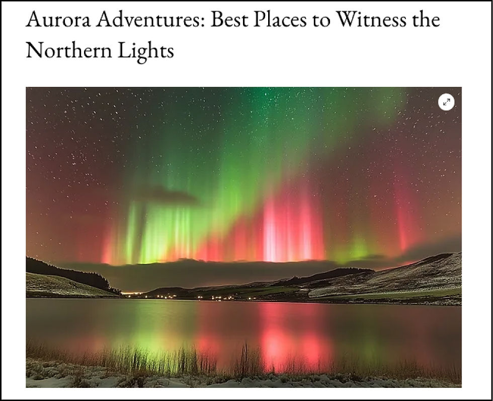
Description: Located at the longitudinal center of Canada, Manitoba is known for its prairie landscapes and northern Arctic tundra. Winnipeg, the capital, features the Canadian Museum for Human Rights and the historic Forks area. The province is characterized by large French-Canadian and Indigenous populations, and its economy is driven by agriculture and natural resources. It is also one of the most notorious places for seeing Polar Bears as Churchill, located on the shores of Hudson Bay, is famous for encounters with the beasts and the residents have used that to develop a strong tourism industry around it. The encounters can be so unexpected that it is common for people to leave their cars unlocked so that others can escape the bear! The area is also well known for aurora tours.
Places to Visit:
Location: Located in Lake Winnipeg, about a two-hour drive north of Winnipeg.
Description: Hecla Island is a serene getaway situated in Hecla-Grindstone Provincial Park. This picturesque island features a diverse landscape that includes rocky shores, dense forests, and extensive wetlands, providing an ideal habitat for a wide range of wildlife. The island's history is richly layered, heavily influenced by its Icelandic heritage, which is still celebrated in the community and through various cultural exhibits and events.
Visitors to Hecla Island can enjoy a variety of outdoor activities, such as hiking along scenic trails that offer breathtaking views of Lake Winnipeg, bird watching in one of Manitoba’s most diverse avian habitats, and golfing on a beautiful lakeside course. For relaxation, there are numerous resorts and lodges that provide comfortable accommodations and access to spa services, making Hecla Island a popular destination for both adventure and relaxation amidst natural beauty. The name Hecla actually comes from a volcano in Iceland (Mount Hekla).
Historical Significance: Settled by Icelandic immigrants in the 1870s, the island is home to a museum and historic village that recreates life in an early 20th-century Icelandic fishing community, complete with restored buildings and interpretive displays.
Location: Approximately 450 km north of Winnipeg.
Description: Known as the world’s largest marl, or calcium carbonate-rich lake, it is some 4km by 15km. With warmer temperatures, the marl forms into calcite and separates from the water, which creates crystals and leads to a brilliant turquoise color. When it cools, the calcite dissolves once again, turning the water crystal clear. Visit in the summertime to get the most dramatic changes and bring your fishing gear to try and catch pike, whitefish and walleye in the lake.
Historical Significance: Not particularly historically significant, but it is a geological wonder and a key area for conservation.

Lakeside Sunbathing
Spirit Sands and Devil's Punch Bowl
Location: In Spruce Woods Provincial Park, southwestern Manitoba.
Description: Similar to the Sand Hills in SK, this area also features desert-like sand dunes and a strikingly contrasted pool of blue-green water known as the Devil's Punch Bowl. This is predominantly an area for hiking and some of the trails can be challenging. There are other activities there for families though such as some shorter hikes, mini golf, and you can even take a tour of the area on a covered wagon. Make sure you bring along the bug spray especially if going in Summer as the mosquitos can be fearsome. Bring plenty of water too. Maybe Spring would be the best time to visit come to think of it.
Historical Significance: The area holds cultural significance for the Assiniboine people and was a trading area during the fur trade era.
5. Ontario

Capital: Toronto
Description: Ontario is Canada’s most populous province and houses both the capital city of Toronto and the national capital, Ottawa. Toronto is a multicultural hub with a bustling arts scene, while Ottawa is known for its federal government buildings and museums. Ontario’s economy is diverse, encompassing manufacturing, services, agriculture, famous ice wine, and technology. Ontario is almost always associated with Niagara Falls and if you've never been then they are certainly worth a visit, but it is overcrowded, touristy and expensive so if you do go there, consider staying in Niagara on the Lake instead.

Places To Visit:
Fathom Five National Marine Park
Location: At the tip of the Bruce Peninsula, near the town of Tobermory.
Description: Canada's first National Marine Conservation Area, famous for its clear waters, shipwrecks, and scuba diving opportunities. While you are in the marine park make sure to include a trip out to Flowerpot island where you can take pics of the rock pillars and hike the interior of the island.
Historical Significance: The waters around the park are known as the "Shipwreck Capital of Canada," with numerous vessels resting on the lakebed, telling stories of the perilous conditions of maritime travel and trade on the Great Lakes.

Rock Towers on Flowerpot Island
Location: In Lake Superior Provincial Park, north of Sault Ste. Marie.
Description: The Agawa Rock Pictographs Trail spans a manageable 0.8 km loop that takes adventurers to the pictographs, which are one of Ontario’s most extensive collections of Aboriginal pictographs. The moderately challenging path is notable for its some geological features, including a steep rock-carved staircase, imposing cliff faces, and rugged, boulder-strewn routes, making the journey an adventure in itself. Upon reaching the destination, visitors can observe the pictographs from a rock ledge beneath the cliff, overlooking Lake Superior, with a metal chain anchored into the rock to assist them along the precarious ledge. This ledge cannot be accessed during rough waters on the lake.
Historical Significance: Created by the Ojibwe people of the Great Lakes region, these pictographs are several centuries old and represent one of the most accessible locations (if you are a decent hiker) to see such ancient artworks in North America.

Some Pictographs
Location: Along the St. Lawrence River, between Ontario and New York State.
Description: The Thousand Islands region is an archipelago of over 1,800 islands that vary dramatically in size from over 100 square kilometers to smaller islands that merely hold a single residence or are uninhabited patches of rock. This area is famed for its rich biodiversity and stunning natural beauty, offering a picturesque mix of lush, wooded islands and clear blue waters. The region is a haven for boating, fishing, and water sports, supported by well-developed tourist facilities including historic castles, cozy cottages, and ample recreational areas. The largest island in the group is Wolfe Island and is entirely in Ontario. Some other large islands in the archipelago include New York's Grindstone Island and Wellesley Island. And yes, if you were wondering, the salad dressing is named after these islands!
Historical Significance: The Thousand Islands have a storied past involving Native American communities, European settlers, and later the elite of the Gilded Age who built opulent summer homes and castles here. Boldt Castle on Heart Island and Singer Castle on Dark Island are just two examples of the luxurious estates that were constructed during the area’s heyday as a retreat for the wealthy. The islands also played roles in bootlegging during Prohibition and were strategic sites during the War of 1812 and the Patriot War of 1837-38. The region's rich history is preserved in numerous museums and heritage sites scattered across the islands, making it not only a place of natural wonder but also a significant cultural landmark.
6. Québec

Capital: Québec City
Description: Québec is Canada’s largest province by area and is predominantly French-speaking. Québec City, the capital, is one of North America's oldest cities, with its well-preserved historic district, Old Québec. Montreal, the largest city, is known for its cultural vibrancy and arts scene. The economy includes aerospace, technology, and hydroelectric power.
Places to Visit:
Location: Northeast of Québec City, in the Saguenay–Lac-Saint-Jean region.
Description: The fjord is part of a national park, which is ideal for both summer adventures and winter sports.The fjord itself is an awe-inspiring natural wonder, carved by ancient glaciers and stretching over 100 kilometers from the St. Lawrence River deep into the rugged landscape of the Canadian Shield. This dramatic fjord is one of the largest and southernmost fjords in the world, featuring towering cliffs that rise over 350 meters above the dark waters, creating a stunning vertical landscape that is a magnet for outdoor enthusiasts and nature lovers.
Visitors to Saguenay can engage in a variety of activities, including kayaking, where they can paddle alongside steep rocky walls and possibly spot beluga whales that frequent the fjord's waters. Hiking trails along the fjord offer spectacular views and connect to quaint villages where the heritage of the area, steeped in the traditions of the Québécois, can be explored. In winter, the fjord transforms into a snowy wonderland, offering opportunities for cross-country skiing and ice fishing. The Saguenay Fjord is not only a place of breathtaking beauty but also a vibrant ecosystem supporting a diverse range of flora and fauna, making it a pivotal area for ecological study and conservation efforts.
Historical Significance: The area is culturally important to the region and was a critical site for the 19th-century timber trade.
Location: In the Gulf of Saint Lawrence, accessible by ferry from Prince Edward Island or by plane.
Description: Known for their wind-sculpted red sandstone cliffs, beautiful beaches, and the warm hospitality of the local Acadian and Québécois communities. Activities include windsurfing, kiteboarding, and exploring local artisan shops. The islands are at risk of constant erosion by the sea and the rising sea levels have made this situation even worse. In particular, parts of the shoreline have receded by as much as 4.3 meters per year during the 2010s. Given the current trends and the expected acceleration in sea level rise, the long-term outlook for the Magdalen Islands is concerning. It is projected that the islands will continue to face significant geographical changes, further challenging the resilience of the local communities and ecosystems.
Historical Significance: The islands have a rich maritime history, with many shipwrecks surrounding the archipelago, reflecting its strategic location and challenging navigational waters.

Reford Gardens (Jardins de Métis)
Location: Near Grand-Métis, along the southern shore of the St. Lawrence River in eastern Québec.
Description: Created in the 1920s by Elsie Reford, the gardens host thousands of plant species, including a notable collection of rhododendrons and azaleas. The gardens are noted for their diverse collection of both native and exotic plants, which have been carefully managed and maintained to preserve the local ecosystem. The team at Reford Gardens actively engages in projects to protect and restore the local environment, including shoreline restoration to counteract erosion and the introduction of native species with beneficial properties.
The focus at Reford Gardens has been on sustainable horticulture and conservation, suggesting a mindful approach to the introduction of non-native species. Thus, while the introduction of exotic plants was part of Elsie Reford's legacy, the current management practices appear to prioritize ecological health and stability.
The site also features contemporary art installations and hosts the annual International Garden Festival, showcasing innovative garden designs from around the world.
Historical Significance: The gardens are historically significant as one of Canada's National Historic Sites. They reflect early 20th-century gardening aesthetics and Elsie Reford's pioneering work in horticulture, particularly her efforts to adapt many non-native species to the Quebec climate.
7. New Brunswick

Capital: Fredericton
Description: As one of Canada's three Maritime provinces, New Brunswick features a bilingual (English and French) environment. Fredericton, the capital, is known for its historic government buildings and vibrant arts scene. The province's geography includes river valleys and the rugged Atlantic coastline, and it has a strong focus on forestry and fishing.
Places to Visit:
Location: Near St. Martins, about an hour's drive from Saint John.
Description: This coastal drive offers breathtaking views of the Bay of Fundy, access to secluded beaches, and a chance to see the Fundy Footpath, a renowned hiking trail. Some other trails in the area are only available to hike during a short window during low tide. The Bay of Fundy is famous for having the highest tidal range in the world. The difference between high and low tide can be as much as 16 meters, creating a unique and dramatic natural spectacle. This phenomenon is due to the unique shape and size of the bay, which amplifies the tides as they move in and out.
Besides its remarkable tides, the Bay of Fundy is also known for its rich marine biodiversity. The nutrient-rich waters support a variety of marine life, including several species of whales, seabirds, and the rare North Atlantic right whale. The area offers excellent opportunities for whale watching, bird watching, and exploring coastal ecosystems.
Historical Significance: The area showcases the logging and shipbuilding heritage of the region, with historical sites along the parkway.
Location: On the east coast of New Brunswick, north of Moncton.
Description: Features some of the warmest saltwater beaches in Canada, along with rich bogs, forests, and lagoons. It’s great for kayaking, cycling, and bird-watching. The park has been designated by the Royal Astronomical Society of Canada as a dark sky preserve which is committed to protect and preserve the night sky by applying strict lighting guidelines to reduce light pollution. The guidelines are tailored to protect ecosystems, reduce energy consumption and maintain dark skies. Because of this, camping is very popular in this park giving guests amazing nighttime skies.
Historical Significance: The park was the site of several Acadian settlements, and its creation in the 1960s led to controversial land expropriations, which are remembered in local histories.

Dark Sky Preserves Offer an Amazing Chance to View Our Galaxy
Location: In Sackville, near the Nova Scotia border.
Description: Calling all bird enthusiasts. This park features extensive wetlands in a serene setting that spans over 55 acres of wetlands and forested areas that provide habitat for numerous bird species, offering wonderful bird-watching opportunities. There are over 3 km of accessible trails (boardwalks and footpaths) to explore in this park along with the opportunity to see some 160 species of birds. Bring your binoculars along to see them up close.
The park is not only a recreational spot but also serves an educational purpose with its interpretive signs that explain the ecological importance of wetlands and the various species that inhabit them. It’s an excellent place for educational outings, allowing students and families to learn about environmental conservation firsthand. The conservation efforts in the park have been successful in maintaining a balanced ecosystem that supports a wide range of wildlife, making it a model for similar habitats across the region
The park is free and can be navigated on a self-guided tour but during the summer they offer guided tours as well for a small fee.
Historical Significance: Historically, the Tantramar Marshes, which surround Sackville, were utilized by the Mi'kmaq people and later by Acadian settlers for agriculture, particularly for dyking and farming, leveraging the fertile marshlands. The area is a testament to the intricate system of dykes built by the Acadians in the 17th century, which transformed the landscape and supported their agrarian lifestyle. This system has shaped the local ecology and continues to influence it today.
8. Nova Scotia

Capital: Halifax
Description: Nova Scotia is a peninsula known for its coastal beauty and maritime culture. Halifax, the capital, has a significant shipping and naval history, showcased in its Maritime Museum of the Atlantic. The province is known for its high tides, lobster fishing, and vibrant Celtic and Acadian cultures.
Places to Visit:
Location: At the western tip of Nova Scotia, accessible via two ferries from Digby Neck.
Description: This island is the epitome of rugged Atlantic beauty, featuring rocky shores, lush vegetation, and an abundance of wildlife. Brier Island is particularly popular for its exceptional whale watching opportunities, with the nutrient-rich waters of the Bay of Fundy attracting several species of whales, including humpbacks and the rare North Atlantic right whale.
The island’s extensive trail system allows visitors to explore its unique ecosystems, from coastal bogs to basalt headlands, offering panoramic views of dramatic cliffs and the expansive ocean. Bird enthusiasts will find Brier Island to be a paradise, as it serves as an important stopover for migratory birds along the Atlantic Flyway. The island’s commitment to conservation is evident in its preserved natural areas and the active community involvement in environmental protection. A visit to Brier Island not only promises breathtaking natural experiences but also a peaceful retreat from the hustle of modern life, making it a cherished destination for those seeking solitude and natural beauty.
Historical Significance: A historically significant whaling station in the past, it's now a center for marine conservation and research.

Fishing Village in Nova Scotia
Location: Cape Breton Island, starting and ending at the town of Baddeck.
Description: While the Cabot Trail itself is well-known, the smaller communities and hidden coves along the trail offer secluded beauty, artisan shops, and local seafood. The trail circles the northern portion of Cape Breton and is one of the most famous drives in Canada but there are a lot of secluded places just off the main NS-30 highway. Especially at the northern tip where you can make a side venture out to places like Meat Cove and Shag Rock for some lovely scenic hikes.

Read About the Cabot Trail Road Trip and Others Historical Significance: The area is rich in Gaelic and Acadian culture, and the trail is named after John Cabot, an explorer who landed in North America in 1497, quite possibly on Cape Breton Island.

Coastline in Nova Scotia
Location: Inland Nova Scotia, near Annapolis Royal.
Description: Known locally as Keji, the park offers a blend of old-growth forests, waterways, and abundant wildlife, with excellent camping, canoeing, and hiking opportunities. Be sure to visit the Kejimkujik Birch Bark Canoe Project where you can witness the crafting of a traditional birch bark canoe as it is being made.
Historical Significance: The park contains several petroglyph sites showing the cultural history of the Mi’kmaq people, dating back thousands of years. Enrich your visit to Kejimkujik with their guided tour of some of the 500 petroglyphs that are found in the park.
9. Prince Edward Island

Capital: Charlottetown
Description: The smallest province in both area and population, Prince Edward Island (PEI) is known for its red sandy beaches and fertile agricultural land. Charlottetown, the capital, is famous as the "Birthplace of Confederation." The economy is driven by agriculture, particularly potatoes, tourism, and fishing. The island is small enough that you could do a long weekend and see all of the places on this list. Staying towards the eastern end of the island would put you closest to two on this list but you could drive from one end of the island to the other in under 3 hours so anywhere you pick is fine.
I stayed in North Rustico which is fairly central in the island on the northern side. It put me close to Cavendish Beach, and the historic house which was the inspiration for Lucy Maud Montgomery's "Anne of Green Gables" books. Lucy lived nearby this house and knew the area well. She named the home Green Gables and it became the home of her characters, Marilla and Matthew Cuthbert, who become Anne’s adoptive parents in her novels. The house is now a museum of sorts and you can walk through and immerse yourself in the book's settings.
Places to Visit:
Location: Near Souris, on the eastern tip of the island.
Description: Basin Head Provincial Park is famed for its pristine "singing sands," a phenomenon where the sand squeaks beneath your feet due to its high silica content and the shape of the sand grains. This park boasts one of the most beautiful beaches on the island, featuring miles of white sand alongside crystal-clear waters. It's a popular spot for swimming and sunbathing, thanks to its warm waters, which are some of the warmest north of Florida during the summer months.
The park also includes a museum dedicated to the local fishing industry and a boardwalk that spans the length of the beach, offering scenic views and easy access to the sand. Basin Head is not just a haven for beach-goers but also a protected area for various species of wildlife and plants, enhancing its appeal as a destination for naturalists and casual visitors alike.
Historical Significance: While not historically significant in the traditional sense, the area is a testament to PEI’s natural heritage and tourism appeal.
Location: Near Darnley, on the north shore of the island.
Description: Famous for its distinctive red sandstone formations and dunes, it's a quieter alternative to the more crowded Cavendish Beach which is located in PEI National Park. The beach is celebrated for its unique rock formations, in particular the Teacup Rock which unfortunately was destroyed by Hurricane Fiona in 2022 . This picturesque beach still offers a striking contrast between the soft sands and the rugged, iron-rich red cliffs shaped by the relentless forces of wind and water.
Just a short drive from Kensington, Thunder Cove attracts visitors who come to admire its natural beauty and explore its accessible yet visually dramatic coastline. The beach's unique geological features make it a favorite spot for photographers and nature enthusiasts, providing a serene setting for both relaxation and exploration along the shores of PEI.
Historical Significance: While not historically significant in a traditional sense, its geological features are part of the island's broader natural and cultural landscape.

Teacup Rock in Thunder Cove Before Fiona
Location: Part of PEI National Park, located in the northeastern part of the island.
Description: Greenwich, located within Prince Edward Island National Park, stands out for its distinctive ecosystems and cultural history. This area features some of the most diverse biological systems in Atlantic Canada, including parabolic dunes, wetlands, and numerous species of rare and endangered plants. The shifting sand dunes are a sight to behold, accessible via a floating boardwalk that allows visitors to explore without disturbing the fragile habitat.
This section of the park offers a blend of natural beauty and historical depth, providing educational and recreational opportunities through its interpretative center and well-marked trails that guide visitors through the stunning landscapes and seascapes.
Historical Significance: Greenwich's history is just as rich, with archaeological findings indicating that the area was once used by the Mi'kmaq people and early European settlers. It's also home to the extensive and well-preserved archaeological site of a palaeo-Indian encampment, dating back over 10,000 years.
10. Newfoundland and Labrador

Capital: St. John's
Description: The easternmost province of Canada, Newfoundland and Labrador, is known for its rugged coastal landscapes and maritime heritage. St. John's, the capital, is famed for its colorful row houses and as the starting point for transatlantic aviation. The province has a strong fishing tradition, though oil and mineral extraction have grown in importance.
Places to Visit:
Location: On the northeastern coast of Newfoundland, known as the "Iceberg Alley."
Description: Beyond iceberg viewing, Twillingate offers a charming small-town atmosphere, coastal trails, and a vibrant arts community. A short drive away and you can take in the view from Long Point Lighthouse. More than 91m above sea level, this is a lookout point with a panoramic view of the Atlantic Ocean and the chance to view icebergs, whales, seals and sea birds.
Historical Significance: Historically, it was one of the most important fishing communities in Newfoundland.
Location: On the southeastern tip of the Avalon Peninsula.
Description: Named for the navigational hazard it posed to sailors, this area is now known for its Precambrian fossils, some of the oldest on Earth, visible on its rugged coastal cliffs. Take a guided tour to see the fossils and stand on the ancient sea floor that dates back as far as 565 million years ago. The pre-dates Pangaea and even the first plant life by over 100 million years! Talk about taking a journey back in time. While there, visit the Myrick Wireless Interpretation Centre and the Titanic Exhibit to learn about the earliest days of wireless communication and the role the point played in the Titanic disaster.
Historical Significance: The site is significant for its well-preserved evidence of early life on Earth, leading to its designation as a UNESCO World Heritage Site.

Location: At the tip of the Great Northern Peninsula of Newfoundland.
Description: It’s the only confirmed Norse settlement in North America outside of Greenland, offering reconstructed Viking buildings and interpretive tours. The settlement dates back over a thousand years ago, some 500 years before Columbus. The Viking settlement has been recreated into an immersive experience with characters and activities to educate visitors on their way of life at the time. There is even an escape room type adventure with a Leif Erikkson twist where hyou need to solve the clues using your knowledge gained on your visit to the L’Anse aux Meadows National Historic Site.
Historical Significance: A UNESCO World Heritage site, significant for its role in pre-Columbian transatlantic contacts.
11. Yukon

Capital: Whitehorse
Description: Famous for the Klondike Gold Rush, Yukon offers vast wilderness areas ideal for outdoor activities. Whitehorse, the capital, serves as a gateway to the surrounding natural beauty and historic sites. The economy is primarily driven by mining and tourism.
Places to Visit:
Location: Stretches from near Dawson City in Yukon to Inuvik in the Northwest Territories.
Description: Offers breathtaking views of the tundra, mountains, and Arctic landscape. It’s ideal for those seeking solitude and adventure in the far north. The road trip will take you 740 km through some of the most remote and beautiful landscapes you could imagine. There are a few small towns and campgrounds along the way for supplies and plenty of scenic stops.
Make sure to top up your gas tank at any spot possible as you won't have a lot of chances to do so and keep a watchful eye out for wildlife - it is not uncommon to see a herd of caribou crossing the highway. This highway is the only one in Canada that crosses the Arctic circle so it is a bucket list item for a lot of adventurers. Looking to extend your trip? Consider driving another 160km northwards and end at the Arctic sea in Tuktoyaktuk. Make sure to plan well ahead for this trip as the Dempster highway is not open year round.
Historical Significance: It follows ancient dog sled trails and is named after William John Duncan Dempster, a Northwest Mounted Police (later to become the RCMP) officer. He is best remembered for his involvement in search and rescue missions. Notably, in 1911, he led a rescue mission to find the Lost Patrol, a group of four Mounties who had disappeared while patrolling between Fort McPherson and Dawson City. Dempster's successful navigation and survival skills during this mission were instrumental, but sadly he found that all members of the patrol had perished.
Location: Near Carcross, between Whitehorse and Skagway, Alaska.
Description: Often billed as the world’s smallest desert, Carcross was originally called Caribou Crossing due to the large number of woodland caribou that migrated through the area. Despite its name, it is technically not a true desert but rather a series of northern sand dunes. The area covers approximately 260 hectares and is what remains of a glacial lake bed from the last Ice Age, with the fine sands left behind by the melting of glaciers. The desert is surrounded by a diverse landscape that includes dense forests and mountainous terrain, offering a stark contrast to the sandy dunes.
The Carcross Desert provides a unique ecosystem supporting a variety of plant and animal life adapted to its sandy conditions. It is also a popular spot for tourists and locals alike, offering activities such as sandboarding and hiking. The desert's scenic and unusual appearance makes it a favorite subject for photographers and a picturesque spot for adventurers. While there, visit Bennett Lake beach and brave the cold waters of the lake.
Historical Significance: The area is historically significant to the Tagish First Nation and was an important trade and travel route during the Klondike Gold Rush.

Kluane National Park and Reserve
Location: Southwest Yukon, near the Alaska border.
Description: Kluane National Park and Reserve is a majestic region characterized by its rugged mountains, extensive ice fields, and rich biodiversity. Covering an area of over 22,000 square kilometers, the park is renowned for housing Mount Logan, Canada’s highest peak, which rises to 5,959 meters. This UNESCO World Heritage Site is part of the largest non-polar ice field in the world, with vast glaciers that sculpt the park’s dramatic landscapes.
Kluane’s diverse habitats support a wide range of wildlife, including grizzly bears, Dall sheep, and numerous bird species such as the golden eagle. The park's extensive trail system and the opportunities for mountaineering and rafting attract adventurers seeking to explore its remote wilderness, while its critical role in environmental and glaciological research underscores its global scientific significance.
Historical Significance: The park is part of the traditional territory of the Southern Tutchone people, who have lived in the region for thousands of years.
12. Northwest Territories

Capital: Yellowknife
Description: Known for its remote, rugged landscapes and indigenous cultures, the Northwest Territories feature the spectacular Northern Lights. Yellowknife, the capital, started as a gold mining town and is now a center for diamond mining and tourism.
Places to Visit:
Location: Covers a vast area in the northeastern part of the territories.
Description: Characterized by its sparse vegetation and abundant wildlife, including caribou and muskox. It’s a true wilderness experience. You may be lucky enough to witness arctic wolves pursuing the caribou herds as that is their primary food source. There are some lovely all inclusive lodges one can stay at and take wildlife tours and do a little fishing.
Historical Significance: The lands have been the hunting and migration grounds for various Indigenous peoples for thousands of years.
Location: In Nahanni National Park Reserve, accessible by air from Fort Simpson
Description: At twice the height of Niagara Falls, it's one of the most powerful waterfalls in Canada, set in a spectacular canyon. The falls break around a spire of resistant rock in the centre named Mason's Rock after the famous Canadian canoeist, author, and filmmaker. You can arrange a private tour where a pilot will fly you over the falls and also visit some other local attractions.
Also in Nahanni Park are the Rabbitkettle Hot Springs which are naturally occurring hot springs. The springs are located on a limestone plateau and feature two prominent travertine mounds. Travertine is a type of limestone formed by the precipitation of carbonate minerals from mineral springs. It is often beautifully textured due to the layering of carbonate deposits over time. The North Mound, standing at 20 meters tall and measuring 70 meters in diameter, is notable as the largest free-standing travertine mound in Canada. This geological formation showcases the natural processes of mineral deposition, creating a stunning and significant natural feature.
Historical Significance: The Nahanni region is steeped in Indigenous culture and was one of the first natural UNESCO World Heritage sites in the world.

Virginia Falls - Image Credit Paul Gierszewski on Wikimedia Commons
The Wood Buffalo National Park
Location: On the border between Alberta and the Northwest Territories.
Description: Wood Buffalo National Park is the largest National Park in Canada and is one of the largest conservation areas in the world, sprawling over 44,807 square kilometers. It features a diverse landscape of grasslands, wetlands, and boreal forests, providing crucial habitats for species such as the whooping crane, peregrine falcon, wood bison (obviously), and the elusive Canada lynx.
The park is also home to the world’s largest beaver dam, and the Peace-Athabasca Delta, one of the largest freshwater deltas in the world. The beaver dam is even visible from space and that is actually how environmental scientist Jean Thie discovered it in 2007 noting that it was visible in satellite images taken as far back as 1990. While researching beaver dams he found this massive structure using Google Earth. This UNESCO World Heritage Site offers visitors a unique glimpse into the ecological processes of boreal and northern ecosystems and serves as a vital research area for ecological and wildlife studies.
Historical Significance: Established in 1922 to protect the remaining herds of wood bison, the park has since become a sanctuary for an impressive array of northern boreal wildlife.
13. Nunavut

Capital: Iqaluit
Description: Nunavut is Canada’s newest and largest territory, formed in 1999. It is predominantly Inuit and covers most of the Canadian Arctic Archipelago. Iqaluit, the capital, is located on Baffin Island and serves as a governmental and cultural center. The economy is based on mining, fishing, and sealing.
Places to Visit:
Location: On Baffin Island, accessible from the communities of Pangnirtung and Qikiqtarjuaq.
Description: Auyuittuq National Park offers some of the most extreme and stunning Arctic landscapes in the world. Its name, meaning "the land that never melts," perfectly captures the rugged and enduring nature of this terrain, dominated by steep granite cliffs, deep fjords, and extensive glacier systems. The park is a challenging and enticing destination for adventurous travelers, with opportunities for mountaineering, skiing, and hiking the famous Akshayuk Pass—a corridor through the mountains that has been a traditional travel route for Inuit for thousands of years.
The dramatic scenery includes Mount Thor which, at 1250m, boasts the planet's tallest purely vertical drop making it a particular draw for climbers. The mountain consists of solid granite parts of which are among the oldest rocks on Earth dating back 3.5 billion years. Despite its harsh conditions, Auyuittuq is a habitat for a variety of Arctic wildlife, including polar bears, Arctic foxes, and numerous bird species, offering unique wildlife viewing opportunities in one of the world's most remote and untouched environments.
Historical Significance: The park's landscape, particularly the Akshayuk Pass, has been a crucial travel and hunting route for generations of Inuit, providing essential access between communities and to various hunting grounds. The region is rich with traditional knowledge and stories that have been passed down through generations, embodying the relationship between the people and the land. Moreover, the naming of the park itself and many of its features in Inuktitut, the language of the Inuit, highlights the cultural significance of the natural landmarks within it.

Mt. Thor - Image Credit: Swampgoth, CC BY-SA 4.0 <https://creativecommons.org/licenses/by-sa/4.0>, via Wikimedia Commons Location: On the northern tip of Ellesmere Island, one of the most northerly lands in the world. After Woof Buffalo Park, it is the second largest park in Canada.
Description: This park is one of the most remote parks in the world, offering a unique wilderness experience steeped in extreme Arctic conditions and pristine landscapes. This national park, whose name aptly means "top of the world" in Inuktitut, encompasses a vast expanse of polar deserts and ice caps, rugged mountains, and deeply incised glaciers.
The park's isolation and extreme climate have preserved its ecological integrity, making it a haven for unique Arctic wildlife such as muskoxen, Arctic hares, and a variety of migratory birds. For those few who venture to this distant park, it provides unparalleled opportunities for adventure and contemplation amidst one of the Earth's last untouched frontiers.
Historical Significance: Quttinirpaaq is also historically significant, featuring archaeological sites that offer insights into early Paleo-Eskimo and recent Inuit cultures, reflecting thousands of years of human adaptation to harsh Arctic environments.

There are Over 1700 Glaciers on Ellesmere Island Location: On Dorset Island, near the southern tip of Baffin Island is accessible by air from Iqaluit.
Description: Once named Cape Dorset (until 2020) Kinngait, meaning "where the hills" are in Inuktitut, is best known as the Capital of Inuit Art due to its vibrant community of Inuit artists and its significant contribution to the global recognition of Inuit sculpture and printmaking. This small hamlet boasts a rich history of artistic expression, rooted in centuries of cultural traditions and the unique Arctic environment with ties to the ancient Thule people.
The local art co-operative, established in the 1950s, played a pivotal role in transforming local artistic talents into a thriving economic engine for the community, making Kinngait synonymous with exquisite stone carvings and highly sought-after prints that depict traditional Inuit life, legends, and wildlife.
Historical Significance: The community also features cultural sites such as the Kinngait Studios, one of the oldest and most influential print studios in the Arctic, where visitors can witness the creation process firsthand and interact with artists. Kinngait continues to nurture emerging talent, ensuring the preservation and evolution of Inuit cultural heritage through art. Interested in owning some of this incredible art? Find a gallery that carries the authentic Dorset Fine Arts here and browse their collections.


Summary
Exploring Canada's lesser-known gems (ok, some of these may be well-known to some intrepid travelers) offers an enriching journey through diverse landscapes and rich histories, where ancient spiritual significance intertwines with stories of resilience against climate change.
Whether your adventures have you chasing Aurora Borealis, or diving into clear waters housing historic shipwrecks or perhaps treading among the living museums of Indigenous People legacies, each destination invites a deep connection to nature and contemplation on environmental and cultural preservation.
These adventures challenge visitors to not only appreciate the beauty and heritage of these sites but also reflect on their role in safeguarding these treasures for future generations.


Comments